Prices
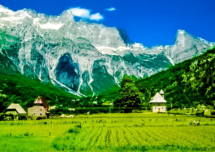
Theth
Thethi -Legend has it that Theth was founded 400 years ago by 6 brothers ,and suggests that the population moved to Theth some 300 to 350 years ago in order to preserve their (Catholic) Christian traditions.
Visiting Theth in the early 20th century, the traveller Edith Durham said:
I think no place where human beings live has given me such an impression of majestic isolation from all the world.
Durham described Theth as a "bariak" of some 180 houses and also observed that it was almost free from the tradition of blood feud (known in the Albanian language as Gjakmarrja) which so blighted other parts of the Albanian highlands
Theth National Park It covers an area of 2,630 hectares and is located along the Theth River. The main attractions in the park are the Grunas Waterfall and the Lock-in Tower.
Theth remains remote. It is most easily accessible by a 25 km unmade road from the village of Boga which is difficult pass during the winter months and is not generally suitable at any time of the year for motor vehicles without off-road capabilities.
Although the Kanun (traditional Albanian law) remains influential, Theth has not suffered from the recent (post-Communist) reappearance of the blood feud which has troubled other areas of Northern Albania. Ironically, Theth boasts one of the very few remaining "lock-in towers", an historical form of protection for families that were "in blood".
Depopulation represents a serious long-term challenge for the community. The population has been greatly reduced over the past few decades and the majority of those remaining occupy Theth only during the summer months. However, the community has a nine-grade school and recent efforts have been made to stimulate tourism. A number of local families offer board and lodging to visitors who come to Theth to hike in the National Park - or merely to admire the mountain scenery
Apart from the lock-in tower, other attractions include spectacular waterfalls, a working watermill (still used to grind the local inhabitants' corn) and a modest ethnographic museum.
There are now two projects working in the vicinity, aiming at improving and helping the tourist infrastructure in the area. A Balkans Peace Park Project is working towards the creation of a park extending across the borders of Albania, Montenegro and Kosovo and has taken a lead in recent years in encouraging sustainable and ecologically sensitive tourism in and around Theth (for example by funding the marking of footpaths). Project Albanian Challenge has built a new bridge, which connects Theth to the nearby Grunas waterfalls over river Nanrreth. The project has also improved the marking of the trail to Curraj i Epërm, and has marked another approx. 80 kilometers of brand new trails in the nearby valleys, and created an opensource, free map of the area.
Valbona National Park
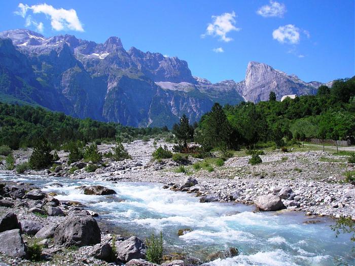
Valbona National Park, in the district of TropojeLocated 25-30 km north-west of the town of Bajram Curri., is one of the most important natural resources in Albania. With the improvement in recent years, the infrastructure and investments of the residents in this part of the Albanian Alps tourism is developing rapidly.
Rated as the miracle of the Albanian Alps Valbona National Park, in the district of Tropoje, lies along Valbona Valley, with an area of 8000 hectares. Mountainous landscape, the waters of the river Valbona and ecosystem of the park in recent years are attracting more and more domestic tourists and foreign, also thanks to the improvement of roadways, power supply, and investment own people for the reception of tourists.
The climate of the valley is quite fresh and hot summer does not exist at all. Valbona village is about 1,000 meters above sea level and lies on a gravel set of Valbona River. Valbona village currently has about 30 houses, mainly old tower two and three-story stone with thick walls and roof characteristic alpine wood paneling. In characteristic towers attract attention very small windows and turrets built in each direction to be protected. In the middle of the village is a bar that serves mainly outdoor, grilled skewer of milk products and snack area. Near the bar is under construction a small basin to increase plover Valbona trout. Valbona no genuine hotel, but some typical tower houses are framed by tradition in hotels for tourists. Accommodation and food prices are reasonable. Through high block Jezerca mountainous north, and Gorges Zhaborreve open in the South formed a typical glacial trough. On the steep slopes of the mountains of White Kollatës District looks permanent snow and climbing them would be a challenge for any climber profesionist.Ujëvara of Rragami located near the village of the same name, above Valbona, is another miracle alpine nature that should not leave without visiting. 4-5 Valbona during winter months is completely isolated from the snow so at this time it is impossible to visit
This is the list of castles in Albania :
- Castle Badhrës
- Castle Bashtova
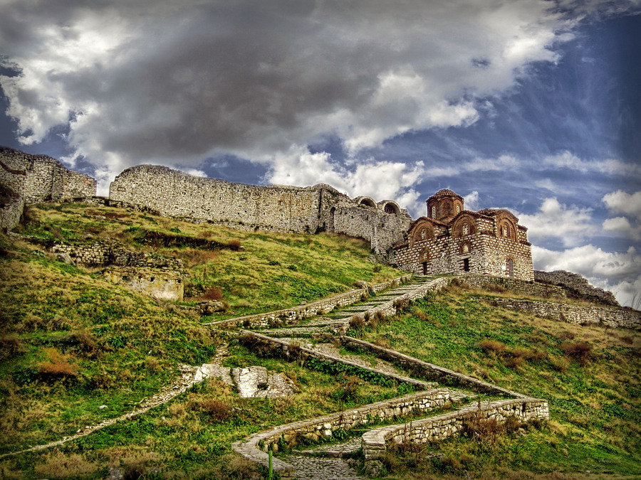
- Berat Castle
- Castle Borshi
- Drishti Castle
- Castle of Durres
- Castle of Elbasan
- Castle Grazhdani
- Castle of Gjirokastra
- Castle of Kanina
- Castle Kardhiqit
- Castle Kruje
- Castle Lëkurësit
- Castle of Lezha
- Castle Libohovë
- Castle Margellici
- Castle Peqinit
- Petrela Castle
- Castle Pogradecit
- Castle of Porto Palermo
- Castle Preza
- Castle of Rodon
- Castle of Shkodra
- Castle Shtëpëzës
- Castle Skela
- Castle Skrapar
- Castle Tepelenës
- Castle Tirana
- Castle Tujanit
- Castle Vokopola
Albanian archaeological park
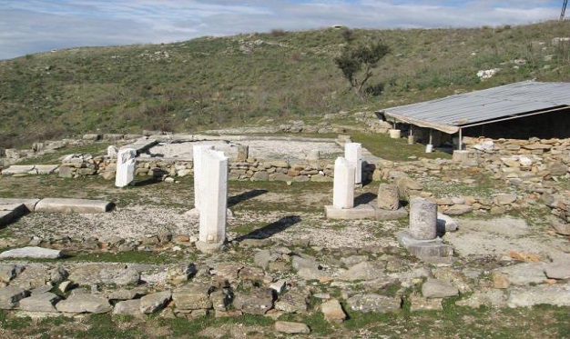
Finiqi
Finiqi located 8 km east of the modern city of Saranda and about 20 km from the Greek border. In antiquity, the area surrounding territory belonged chaonian, Epirote part of the Kingdom, and was further expanded during the Byzantine period, while to the south of the city lies Lake Butrint.
Ancient sources mention the wealth of the city, especially during the Hellenistic period between the third century BC and the second, which was the headquarters of the League Finiqi Epirote.
Within the walls of Finiqit was signed late Macedonian War, the document was named "Peace Finiqit".
Continued prosperity of the city during the Roman Empire, the Byzantine period while register 10 centuries the city continued life. Ottoman conquest of Finiqit came unexpectedly and the city surrendered taking the appearance of a small town.
While visiting Finiqi can see a small temple, theater, Helene home, several Roman baths and a Byzantine church.
Lezha
The ancient town of Lezha is situated somewhere between the ancient road Epidam- Dyrrah (Durres) and Shkodra, built on a hill overlooking the flow of the river Drin. Deodar linking Sicily with Dionysus founding of the city of Syracuse, (385 before K). Lezha appears again on ancient sources only at the end of the Roman Illyrians War when i`u Queen Teuta had to sign a peace treaty forced the Romans. Lezha in 213 BC Macedonia became port on the Adriatic Sea and only in 209 BC Illyrians regained their possession. During 169 BC the city was also one of the residences of the Illyrian king Gent. During the wars between Caesar and Pompey, Caesar controlled the city and reinforced protection.
He continued to be an urban center known Lezha to early medieval period.
Until 1398, the city was under the Dukagjini feudal family, who later forwarded Venice. In this town of Lezha League was held on March 2, 1444, under the leadership of Gjergj Kastriot Skanderbeg, the Albanian national hero. Connecting created a military-political union of Albanian princes and a common Albanian army with 10,000 troops, ready to respond to the threat Osman. After death, Gjergj Kastriot was buried in the Cathedral of St. Nicholas in 1468, although his tomb was destroyed later by the Turks.
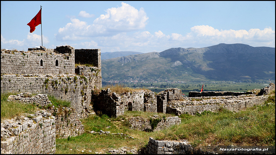
Shkodra
Shkodra is one of the most ancient cities in the north-western Albania. It was founded in the 4th century BC as the center of the Illyrian tribe of Labeates.
Illyrian under King Gent, became the capital of the Illyrian kingdom. This is the period which featured the first coins of the city. In 168 BC fell under Roman rule, while during the first century BC became a Roman colony under the reign of Claudius.
In 395 BC Shkodra became the center of Prevalit Byzantine province, while in 1040 was dominated by Serbia.
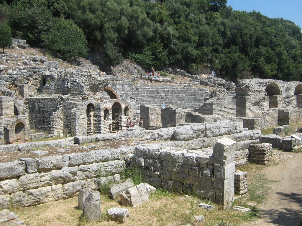
Butrint
Butrint is located in the lower peninsula southwest coast of Albania, south of the modern city of Saranda, opposite the Greek island of Corfu. The area has been occupied at least the eighth century BC, although the origin legends associated with the establishment of the city speak of Trojans. In the 4th century BC, it was built a walled enclosure, and the city became a cult known area dedicated Aesklepidit. Augustus founded a colony at Butrint and the city is supposed to be turned into a small port until the 6th century AD There is little data on the area from the 7th century to the 9th century AD Medieval period was unstable after the city initially became involved in wars between the Byzantines and Normans, the Angevin states and Venice and the second conflict between Venice and the Turks. In the early 19th century, it turned into a small fishing town, surrounded by a Venetian castle.
The main landmarks around Butrint undoubtedly include elegant theater seats Greek and Roman arena with a capacity of 1,500 spectators, in connection with the Greek sacred object Asklepidit. Shortly thereafter west, the Roman way of housing neighborhood located in the east of it are the ruins of Trikonkut close to the channel of Butrint, a font with a large Byzantine mosaic floor dating back to the early 6th century BC, ruins 2 century AD, a basilica and fountain behind very high walls from the time of the Greeks, the Romans, Byzantines, and invasions during the Middle Ages.
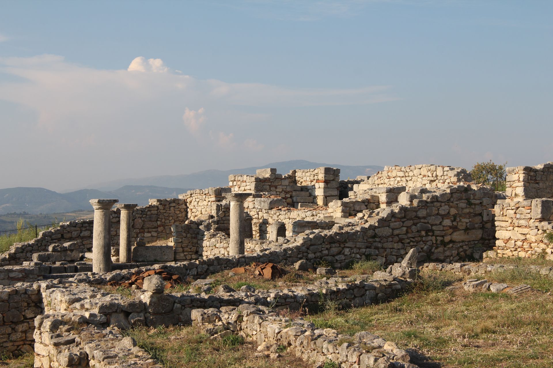
Bylisi
Bylisi was the largest city in Southern Illyria, but despite this fact, is mentioned relatively late by historians and ancient geographers. Its walls have a length of 2250m and surround an area of 30 ha. In the years 49-48 BC i`u city surrendered to Caesar's forces and was used as a base for his large army.
Stephen of Byzantium, wrote that Bylisi Neoptolemusi was founded by the son Achilles.
Despite this fact, the construction techniques date back no earlier than 370-350 BC About 270 BC the city was the center of a political organization of the time, covering about 20 square km.
Bylisi became a Roman colony, during the first years of domination of Augustus, and his name turned colony Julia Augusta. During the period of Late Antiquity, Bylisi became an important center where were established large Paleo- Christian basilica, all containing a number of mosaics.
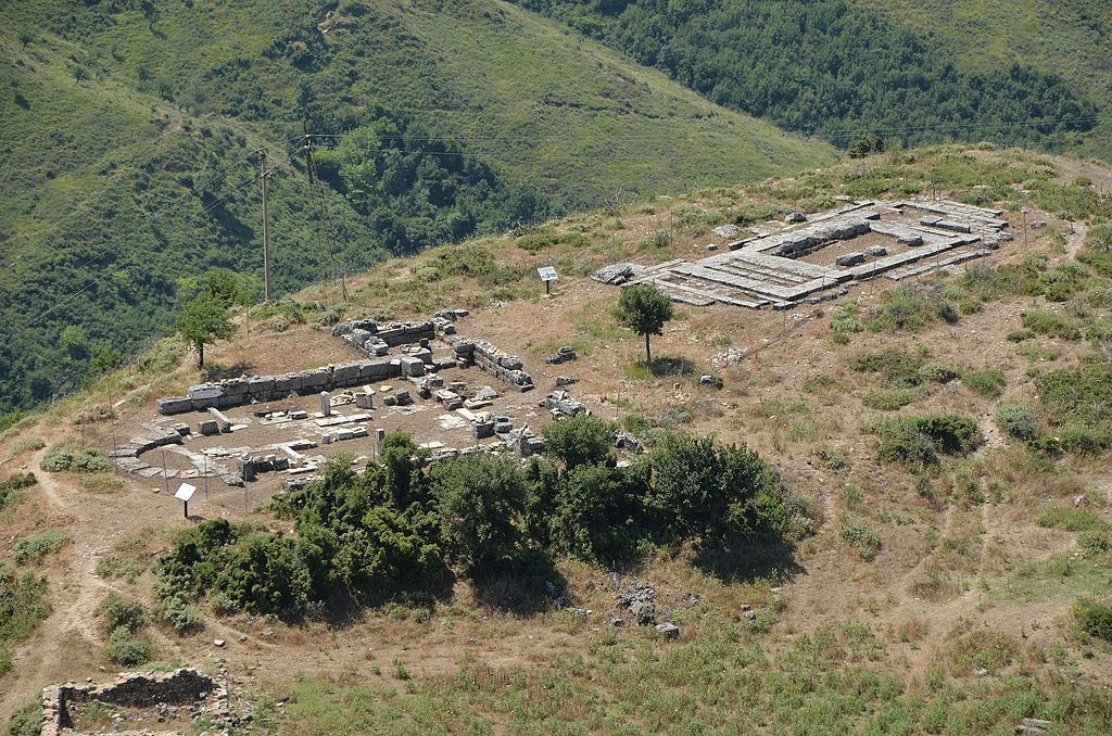
Antigonea
Excavations conducted by Albanian archaeologists near the modern village of Saraginishtit, mainly in the years 1960-1980, on the hill of delirium, east of the Drina valley, led to the identification of the besieged city of Antigone. Identification was based on the discovery of 14 parts mosaic ANTIGONEON bronze inscription, in one of the houses of the Hellenistic to the period.
Early literature sources do not mention the establishment of Antigone circumstances or reasons that name. Different opinions from Antigone Gonatas King of Macedonia cite but convincing founder Pirro speak to the king of Molossians, who built the city in 296 BC, in honor of his wife Antigona.
Antigona lies on a hill about 600m above sea level and the surrounding wall is thought to have had a length of 4 km, covering an area of 35 hectares. Excavations have been found by the Assembly and promenade, 59 m long and 9 m wide. Coins from different cities of the state have been found, which came from Corcyra (modern Corfu), Apollonia, Dyrrahu, Orikumi, Ambrakia but also by the League Epirus, the bulk of which is made of bronze and a small part of silver.
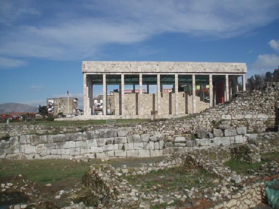
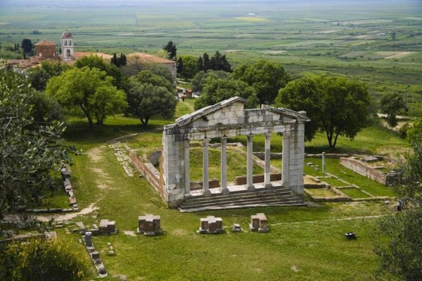
Apolonia
Famous Roman orator Cicero, was amazed by the beauty of Apollonia calling it "magna urbs et gravis" - a magnificent and important city. Founded in the 7th century BC, the Greeks of Corinth and Corfu, the ancient city is located 11 km west of the city of Fier.
Apollonia archaeological excavations show that reached its peak in 4-3 centuries BC In the first century BC, Octavian Augustus studied philosophy there until I received the news of the murder of Caesar in the Senate and was sent to inherit the throne of the Roman empire .
The city had a perimeter wall of 4km length, covering an area of 137 hectares. It is believed that during the phases of development of the city 60,000 inhabitants lived within its walls. According to early data, the interesting monuments worth visiting that are Bouleterioni (city council). Library, triumphal arch, the temple of Artemis, Odeum built in the 2nd century BC, from 77m long promenade, a theater with a capacity of 10,000 spectators, as well as fountain covering an area of 2000 square meters, which was visited by Emperor roman Sulla. 3-4 centuries AD, a considerable part of the Apollonia was destroyed as a result of a large number of earthquakes, this was followed by a change in the South, caused by Vjosa river. Tired and affected by changes in port, earthquakes and Gothic invasion, Apollonia went into a rapid decline, losing all the grandeur of the past.
Today, the area can be visited easily from Fier and offers a unique view of the Adriatic Sea and the surrounding area.
Amantia
The capital of the Illyrian tribe amanti. Remnants of the city are in the village of Ploce near the river valley in the South. It was founded in the 5th century BC and has an area of 13 hectares.
The city has had its acropolis and a Doric style temple dedicated to Aphrodite, built in the 3rd century BC The special monument is the stadium, which is 60 m long and 12.5 m wide. The stadium has 17 degrees on one side and 8 on the other side. One of the most interesting findings is the statue of Lord Amantia fertility dating back to the 3rd century BC This object can be seen close to the archeology sector in the National History Museum, while other findings are exhibited at Amantia Archaeological Museum Tirana.